
 |
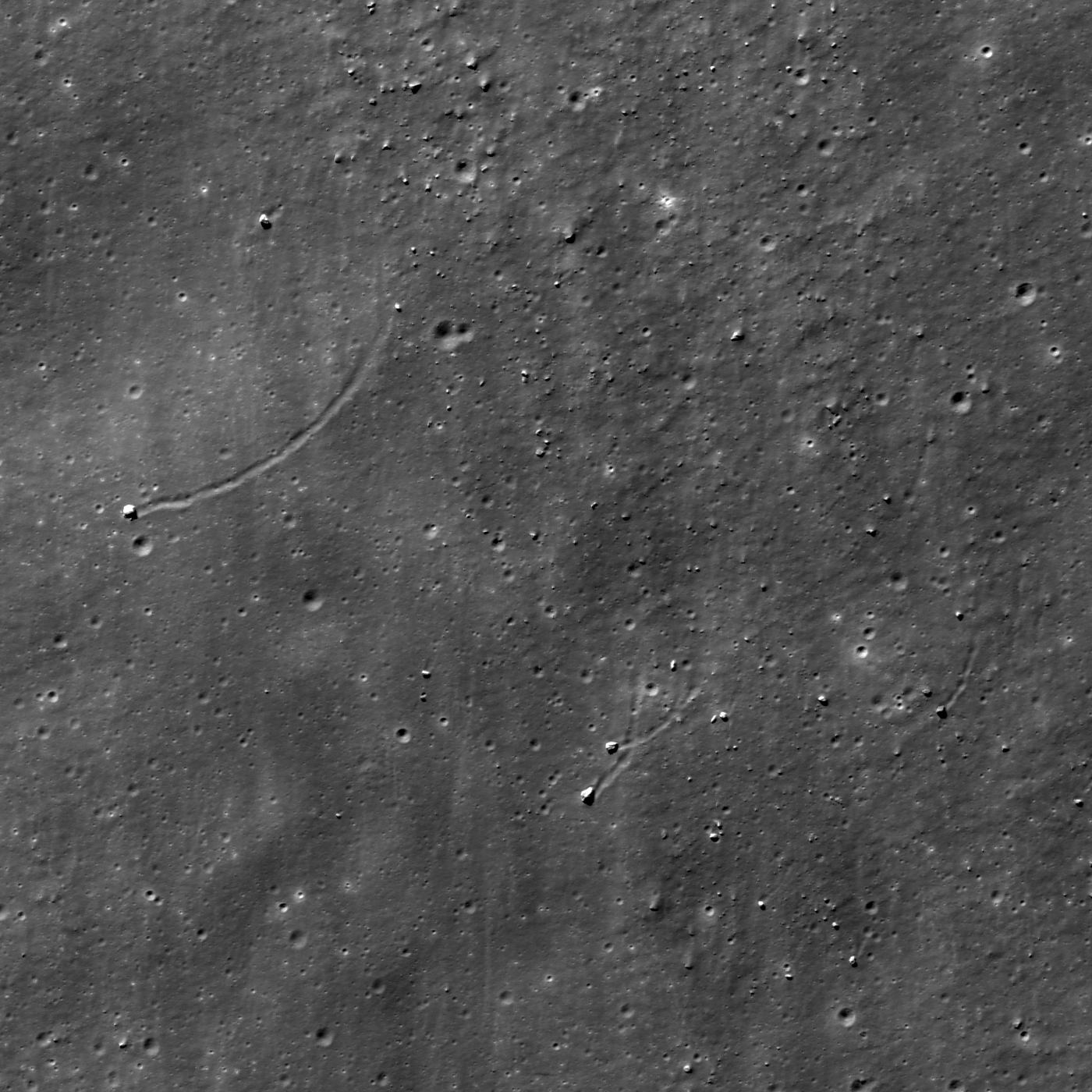
| Curved boulder trails - "not something you see everyday on the Moon!" LROC Narrow Angle Camera (NAC) observation M169772563L, orbit 10153, September 4, 2011; image field of view 756 meters. Angle of incidence 51.17° at 54.8 centimeters resolution from 52.69 kilometers. View the larger LROC Featured Image, released May 1, 2012, HERE [NASA/GSFC/Arizona State University]. |

LROC News System
Boulder trails are one of many examples of how gravity acts on, and changes, the lunar surface over time. Boulder trails are often observed on the interior walls and central peaks of craters because the change in elevation and slope from crater rim to floor is large. Boulder movement on the Moon is highly sensitive to inertia, so when a boulder is knocked loose by an impact or moonquake, it will keep moving until something changes its speed or velocity. But most boulder trails observed on the Moon are relatively linear, forming a more or less dashed line appearance from high elevation to low, so why are the boulder trails in the opening image curved?
 |
| Location of boulders with unusual curved trails visible at high resolution in the LROC Featured Image released May 1, 2012. From LROC Wide Angle Camera (WAC) observation M149716067C (604nm), LRO orbit 7197, January 15, 2011; local evening angle of incidence 77.74° resolution 76.14 meters from 55.18 kilometers [NASA/GSFC/Arizona State University]. |
 |
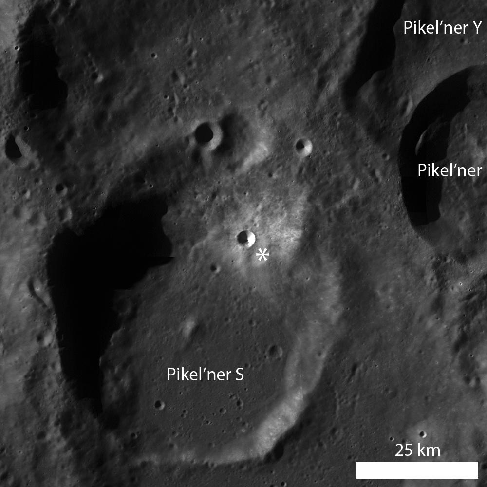
| LROC WAC monochrome mosaic centered on an unnamed ~4 km diameter crater (48.899°S, 121.698°E) in the southern farside highlands. Asterisk notes location of the area of interest highlighted in LROC Featured Image released May 1, 2012. View the larger LROC context image HERE [NASA/GSFC/Arizona State University]. |
The boulder trails are continuous and smoothed, like a marble rolled down a pile of sand, as opposed to disconnected, like a marble bounced down the same sand pile. These observations may provide information about boulder velocity, boulder shape, angle at which the boulder struck the surface, and the coherence of the surface (fluffy versus compacted regolith). Upon landing, the boulders began to travel downhill, forming curved paths according to the local slope, and the small wiggles observed in the trails likely represent the irregular shape of the boulders (because real rocks are not spherical like marbles). The scenario outlined above is strengthened by the observation that the four boulders, which range in size from ~7 m to 9 m, have similarly-shaped curving paths that are sub-parallel. What an exciting geologic location!
Can you find other curved boulder trails in the full LROC NAC image? If so, do your observations support the hypothesis set forth above - why or why not?
Related Posts:
A Recent Journey
Sampling Schrödinger
Frozen in Time
Gassendi's Central Peak
Boulder trails in Menelaus crater
Bright Boulder Trail
No comments:
Post a Comment